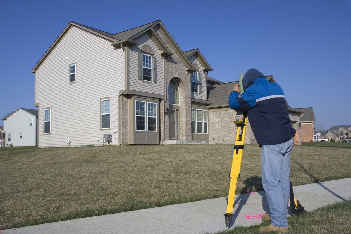
5 Ways Accurate Land Surveying Protects Your Property Investment
Purchasing real estate represents one of the most significant financial commitments you will ever make. To protect this valuable asset, savvy buyers depend on the expertise of professional land surveying companies. Precise boundary determination and thorough site analysis lay a solid foundation for every successful property investment, mitigating risks right from the start. Making an uninformed purchase without precise physical data frequently invites unnecessary financial liability.
1. Preventing Costly Boundary Encroachments
When you purchase a piece of land, you need to know exactly where your ownership begins and ends. Property disputes frequently arise when physical structures like fences, driveways, or retaining walls accidentally cross over onto a neighbor's parcel. Engaging professional land surveying companies before finalizing a purchase reveals these hidden issues, allowing you to address them before they escalate into expensive legal battles. Catching these discrepancies early saves significant time and prevents animosity between adjacent property owners.
Misjudging a property line by even a few inches can lead to catastrophic financial consequences. If you build a permanent structure that violates a boundary line, a court can order you to tear the structure down at your own expense. Skilled technicians utilize advanced measurement technology to map out exact coordinates, providing the definitive proof needed to maintain peace with your neighbors. This objective documentation eliminates any guesswork regarding where your actual authority over the physical space terminates.
Beyond immediate structural concerns, unresolved encroachments can severely diminish the market value of your real estate holding. Future buyers will likely walk away from a transaction if a current boundary dispute clouds the title. By securing a precise, certified map at the outset, you protect your equity and establish a clear, unassailable record of your physical domain. Having this definitive paperwork ready prevents future marketing delays when you eventually decide to liquidate the asset.
2 Uncovering Hidden Property Easements
Easements grant specific third parties, such as utility corporations or municipal governments, the legal right to utilize portions of your land for maintenance or access. A title search might mention these agreements, but it will not show you exactly where they sit on the physical landscape. Relying on reputable land surveying companies allows you to visualize these restricted zones clearly before you formulate any long-term development plans. Failing to identify these zones ahead of time can severely restrict your future expansion options.
Building over a hidden utility main or a designated right-of-way can result in forced demolition and significant fines. If a water authority needs to repair a pipe beneath your new patio, they possess the legal right to destroy that patio to reach their infrastructure. Knowledgeable crews identify these critical zones on your plot map, allowing you to plan your improvements safely around them. Knowing these parameters beforehand keeps your capital improvements safe from future municipal excavation work.
Understanding the precise location of every easement also helps you maximize the usable square footage of your investment. You can position secondary structures, landscaping features, and drainage systems in areas that will never conflict with municipal access rights. This strategic planning preserves the integrity of your layout and prevents unexpected disruptions to your peace of mind. Knowing these exact spatial relationships allows you to use your entire allotment of land effectively and legally.
3. Verifying Accurate Zoning Compliance
Local municipalities enforce strict zoning ordinances that govern how close a building can stand to the property line, known as setback requirements. Violating these local regulations can stop a construction project entirely, resulting in forfeited permits and expensive architectural re-design fees. Certified land surveying companies play an essential role in verifying that your proposed footprint aligns perfectly with all current municipal codes. Local authorities demand absolute compliance with these spatial rules before issuing any final approvals.
According to Vertical IQ, more than 7,000 firms in the surveying and mapping industry employ over 54,800 workers, generating more than $11.7 billion per year. This massive professional infrastructure exists because accurate spatial data is absolutely mandatory for modern civil compliance. Without precise measurements, you risk building a structure that violates height restrictions, lot coverage ratios, or environmental buffer zones. These regulatory mistakes can tie up your investment capital in municipal court for several months.
If a violation is discovered after construction finishes, securing a zoning variance is incredibly difficult and highly improbable. You could face ongoing daily fines or find yourself unable to secure a certificate of occupancy, rendering the building legally useless. Enlisting expert assistance provides the precise documentation required to satisfy local building inspectors and protect your capital. This verifiable proof gives you the confidence to proceed with complex commercial or residential buildouts.
4. Revealing Severe Flood Vulnerabilities
An accurate assessment of environmental risk is just as important as mapping physical boundaries when evaluating a long-term real estate investment. Property lines do not protect your infrastructure from rising waters or poor natural drainage patterns. Experienced land surveying companies perform detailed elevation measurements to determine exactly how your specific parcel interacts with the local watershed and regional flood plains. Knowing the layout of the terrain protects your structures from unforeseen seasonal water accumulation.
FEMA flood maps offer broad regional overviews, but they often lack the granular detail required to evaluate individual building sites accurately. A professional elevation certificate indicates the precise height of your structure’s lowest floor relative to the estimated base flood elevation. High-quality field crews deliver this vital data, which directly influences your mandatory flood insurance premiums and overall carrying costs. Lowering these fixed monthly expenses increases the long-term profitability of your commercial real estate holding.
Ignoring topography can lead to severe structural damage and rapid foundation deterioration over time. Understanding the exact contours of your land enables you to implement proper grading strategies and direct stormwater away from your primary assets. This proactive environmental awareness keeps your buildings dry, structural components intact, and long-term maintenance budgets predictable. Proper water management planning fundamentally extends the overall operational lifespan of your entire physical plant.
5. Facilitating Smooth Future Transactions
Every property owner eventually faces a transition point, whether that involves selling the asset, passing it to heirs, or refinancing a mortgage. Financial institutions and title insurance corporations always require up-to-date, certified spatial data before they approve major funding requests. Keeping current records from established land surveying companies on hand streamlines these complex financial processes and prevents unexpected delays during closing. Clean records keep your real estate highly liquid and attractive to institutional investors.
Lenders refuse to finance projects or purchases that carry unresolved boundary questions or ambiguous legal descriptions. An outdated map from several decades ago will rarely satisfy modern underwriting standards, especially if neighboring parcels have changed hands or undergone development. Maintaining a fresh, certified document accelerates the institutional approval process and demonstrates pristine stewardship to potential buyers. Complete transparency removes the regular friction that often derails high-value commercial sales.
Clear documentation removes the friction of negotiation and reassures buyers that they are receiving exactly what they pay for. It eliminates guesswork, standardizes the asset metrics, and anchors the true valuation of the real estate in verifiable mathematical fact. Investing in professional measurement services today guarantees that your future exit strategy remains profitable, efficient, and completely free of legal complications. This definitive spatial clarity forms the ultimate cornerstone of a successful long-term real estate divestment plan.
Securing accurate spatial data remains a non-negotiable step in executing a successful real estate strategy. By identifying legal boundaries, hidden restrictions, and environmental hazards, professional measurements shield your capital from devastating losses. Committing to professional documentation from the start of your ownership journey protects your wealth and guarantees lasting stability for your property assets. Partner with the professionals at Dontz Surveying & Construction LLC to protect your investment portfolio by scheduling a consultation with one of the most reliable land surveying companies in the region.


Share On: