
10 Common Problems a Land Surveyor Can Prevent
Navigating real estate purchases, property developments, or construction projects requires precise geographic measurements to avoid severe financial disputes and legal complications down the road. Property owners often assume visible landmarks like fences, roads, or mature trees accurately indicate legal boundary lines, leading to accidental encroachments and expensive neighborhood conflicts. Engaging professional mapping experts before breaking ground ensures your investment remains completely protected under local zoning ordinances. By hiring a qualified land surveyor, buyers and developers can identify hidden topographic hazards, unrecorded easements, and structural placement errors early. Professional boundary verification provides long-term clarity, preserving land value and ensuring smooth, hassle-free real estate transactions.
1. Resolving Boundary Disputes Through Accurate Mapping
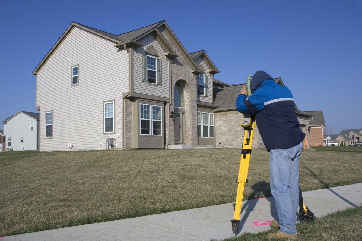
Neighbor disputes over property lines frequently erupt when owners attempt to erect new fences, build driveways, or plant trees along unverified borders. Guessing where one parcel ends and another begins can lead to accidental trespasses and costly court battles with adjacent landowners. A professional land surveyor utilizes specialized GPS technology and historical deed records to mark exact legal boundary points on the ground. Defining precise property lines prevents misunderstandings between neighbors and saves property owners thousands of dollars in potential litigation fees. Clear boundary markers establish legal clarity, ensuring everyone respects correct property limits and maintains peaceful relationships throughout local communities.
2. Preventing Structural Encroachments With Precise Measurements
Building additions, garages, or shed structures over legal property lines creates severe structural encroachments that destroy real estate marketability. Correcting an accidental encroachment after construction finishes often requires tearing down brand-new walls or purchasing additional land slices at inflated prices. Hiring an experienced land surveyor ensures architects and contractors position new foundations strictly within legal setback limits before concrete pours begin. According to Vertical IQ, the surveying and mapping industry is fragmented, with the top 50 companies contributing about 33% of total revenue. This fragmentation means property owners can easily choose among numerous local specialists to secure precise site measurements before starting construction.
3. Identifying Unrecorded Easements Through Historical Research
Utility companies, municipalities, and neighboring property owners often hold legal easements that grant right-of-way permissions across private land parcels. Building permanent structures over forgotten sewer lines, power grids, or shared access driveways can result in forced demolition orders from local authorities. A certified land surveyor conducts comprehensive research into historical deeds and public records to uncover all active land encumbrances before development starts. Mapping legal easements prevents accidental structural interference, ensuring utility crews retain necessary access without damaging private landscaping. Uncovering hidden right-of-way permissions protects property investments and prevents unexpected legal liability during future land expansion projects.
4. Mitigating Severe Flood Risks Through Topographic Surveys
Constructing homes inside unidentified flood zones exposes real estate assets to catastrophic water damage, skyrocketing insurance premiums, and municipal building permit rejections. Standard topographic evaluations determine exact ground elevations relative to nearby natural water bodies and official federal floodplain maps. Consulting a knowledgeable land surveyor allows property developers to secure accurate Elevation Certificates required by mortgage lenders and flood insurance providers. Identifying flood risks early enables builders to modify foundation heights, install proper drainage systems, or select safer construction sites altogether. Proactive elevation assessments safeguard homes against unexpected natural disasters while keeping insurance rates manageable.
5. Ensuring Compliance With Strict Municipal Setbacks
Local zoning laws mandate exact distance setbacks between permanent buildings, side lot lines, public roads, and sensitive environmental wetlands. Constructing a home or commercial building too close to property edges triggers heavy municipal fines, stopped work orders, or mandatory structural teardowns. A skilled land surveyor measures precise setback distances during the initial planning phase to ensure proposed building blueprints satisfy all local zoning regulations completely. Verifying regulatory compliance early prevents costly project delays, eliminates bureaucratic permit hassles, and keeps construction schedules moving forward smoothly. Adhering to municipal zoning parameters protects project budgets and ensures legal structural operations.
6. Streamlining Property Subdivisions With Strategic Layouts
Dividing large land parcels into smaller residential lots requires meticulous mapping to meet local road access, utility placement, and minimum square footage requirements. Poorly planned subdivisions result in unusable land pockets, blocked access points, and rejected municipal planning applications that waste valuable time. Partnering with a professional land surveyor ensures proposed lot layouts maximize usable space while adhering strictly to regional planning standards. Expert mapping facilitates smooth approval processes with local planning boards and zoning commissions, accelerating commercial real estate development schedules. Proper subdivision planning increases total land valuation and opens up profitable sales opportunities for ambitious real estate developers.
7. Clarifying Title Insurance Exceptions Through Detailed Site Plans
Title insurance companies often exclude unmapped boundary overlaps, undisclosed access routes, and physical encroachments from standard policy coverage unless detailed site plans exist. Lenders usually require comprehensive ALTA surveys before approving commercial mortgages or large residential loans to confirm property stability. Requesting a detailed assessment from a licensed land surveyor eliminates hidden title exceptions, ensuring insurance policies cover unforeseen boundary defects completely. Comprehensive title surveys reassure commercial lenders, simplify real estate closings, and protect buyers against ancient property boundary disputes. Securing comprehensive title mapping protects financial investments and prevents costly legal surprises after property sales finalize.
8. Uncovering Environmental Hazards Through Terrain Evaluations
Building on unstable slopes, sinkhole-prone terrain, or protected wetland environments leads to severe structural failures and massive environmental regulatory fines. Standard terrain evaluations evaluate soil stability, slope gradients, and natural water drainage pathways to determine if land is structurally sound for building. Engaging a certified land surveyor provides critical topographic data that engineers need to design stable foundations and effective stormwater control systems. Uncovering physical terrain hazards prevents catastrophic landslides, soil erosion, and structural foundation cracking after heavy rainstorms occur. Comprehensive terrain mapping ensures land developments remain safe, environmentally sustainable, and structurally sound for decades.
9. Verifying Legal Descriptions During Property Transfers
Outdated or poorly written deed descriptions frequently contain mathematical errors, vague landmark references, or obsolete physical markers that confuse modern property boundaries. Transferring property titles with flawed legal descriptions creates title clouds that delay real estate sales and confuse future heirs. A skilled land surveyor cross-references physical property markers with historical land records to correct legal description errors before property ownership changes hands. Rewriting inaccurate deed descriptions ensures land records remain precise, legally binding, and completely up to date. Resolving deed discrepancies early streamlines real estate transactions, reassuring buyers and sellers throughout the property transfer process.
10. Avoiding Construction Delays Through Early Site Marking
Starting construction without clear ground markers leads to misaligned foundations, misplaced utility lines, and constant friction between build teams and site inspectors. Pausing construction work to fix positioning errors inflates labor costs, wastes building materials, and ruins strict project timelines. Enlisting a responsive land surveyor guarantees clear, accurate site stakes that guide heavy machinery operators, masons, and framing contractors from day one. Precise layout staking eliminates guesswork during excavation, ensuring every wall, pier, and utility trench sits in its exact planned location. Early site marking keeps construction projects running efficiently, within budget, and on schedule.
Investing in professional mapping services remains an essential step for protecting real estate purchases, commercial developments, and residential construction projects. From resolving bitter boundary disputes and avoiding structural encroachments to identifying hidden flood risks, precise site measurements prevent catastrophic financial losses. Partnering with qualified mapping experts clarifies legal land descriptions, verifies municipal zoning compliance, and uncovers unrecorded utility easements before breaking ground. Proactive terrain evaluations safeguard properties from unforeseen physical hazards while facilitating smooth title insurance approvals and real estate transfers. Prioritizing accurate land mapping ensures long-term structural security, preserves land value, and delivers absolute peace of mind for every property owner. Are you seeking expert-level land surveying services in the Great Grand Traverse Region in Michigan? The professionals at Dontz Surveying & Construction LLC are eager to assist! Call today for more information.



Share On: