
5 Projects Where a Land Surveyor Makes All the Difference
In the fast-paced world of construction, real estate, and civil engineering, precise measurement and physical spatial awareness are fundamental to long-term success. A professional land surveyor provides the critical groundwork necessary for turning architectural blueprints into safe, legal, and functional reality. While their intricate field work often goes unnoticed by the general public, these licensed specialists form the indispensable foundation of modern infrastructure development. Their unique skill set ensures millimeter precision across a vast array of initiatives, ranging from urban high-density housing to remote environmental conservation. Whether deploying advanced satellite technology or utilizing time-tested optical instruments, surveyors offer the exact spatial data required to maintain regulatory compliance, prevent costly legal disputes, and streamline complex building schedules. Investing in expert surveying early in the development lifecycle protects capital investments, eliminates structural oversights, and ensures that projects of any scale proceed smoothly from initial concept through final construction.
1. Urban Development Projects
Designing modern city infrastructure is one of the most complex challenges in urban planning. Licensed land surveyors provide the essential groundwork for municipal expansion by delivering detailed topographical maps that capture existing ground contours, underground utility corridors, and surface drainage channels. High-precision equipment allows professionals to capture spatial data with incredible accuracy, ensuring that new roads, bridges, and subterranean transit tunnels align perfectly with existing city grids. Surveyors also assist in identifying sub-surface utility lines and natural geological formations, significantly reducing structural risks during deep excavation. Their detailed mapping supports civil engineers and urban architects, providing the spatial baseline needed to design functional, safe, and resilient municipal infrastructure.
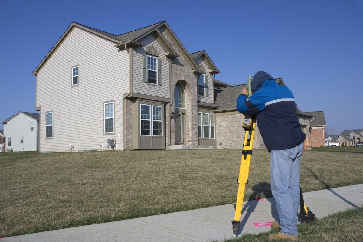
When developing residential subdivisions, the expertise of professional land surveyors is essential for accurate property plotting. They conduct thorough boundary surveys that precisely delineate individual lot lines, ensuring that property boundaries are accurately recorded in public land registries. This meticulous approach prevents future boundary line disputes between neighbors and guarantees full compliance with municipal setback codes. Additionally, surveyors collect critical topographical data that influences site grading, stormwater drainage routing, and utility hookups—elements that are crucial for creating safe, livable communities. By ensuring that every housing plot is correctly marked and graded, surveyors lay a dependable foundation for residential builders.
Navigating complex local zoning regulations is another critical area where land surveyors prove invaluable. Municipal zoning codes govern land use, maximum building heights, lot coverage ratios, and environmental buffer zones. Surveyors translate these complex legal parameters onto the physical landscape by marking clear setback lines, public right-of-ways, and utility easements. This proactive mapping prevents developers from inadvertently encroaching on restricted areas, avoiding costly construction halts and legal penalties. Furthermore, as cities expand, surveyors conduct environmental impact surveys to identify sensitive wetlands and natural habitats, helping developers integrate green spaces into their master plans and maintain ecological balance.
2. Coastal and Floodplain Management
Coastal regions face continuous threats from wave erosion, storm surges, and fluctuating sea levels, making precision surveying essential for shoreline protection. By analyzing coastal topography and tracking long-term erosion patterns, surveyors provide the baseline spatial data required to engineer effective shoreline defenses, such as seawalls, breakwaters, and jetties. Their detailed elevation mapping helps coastal engineers understand the dynamic interactions between land and sea, allowing them to design protective structures that safeguard waterfront properties while preserving surrounding marine ecosystems.
In flood-prone inland areas, land surveyors are indispensable for conducting accurate flood risk assessments and establishing base flood elevations. By evaluating precise ground elevations and natural surface water drainage paths, surveyors help civil planners identify flood hazards and establish safe building criteria. Their work directly informs FEMA floodplain maps, which dictate local building codes, elevation certificate requirements, and flood insurance rates for property owners. As severe weather events become more frequent, the precise elevation data provided by surveyors becomes increasingly critical for protecting residential structures and municipal infrastructure from catastrophic water damage.
3. Agricultural Expansions
The long-term commercial success of agricultural expansions depends on accurate land parcel mapping and clear boundary delineation. Licensed land surveyors measure and map vast agricultural acreage with complete precision, creating legal boundary maps that serve as the foundation for modern farm management. These detailed maps allow agricultural producers to optimize land usage, plan crop rotations effectively, and maximize arable acreage. Clear boundary lines also prevent property line disagreements between neighboring farms, fostering productive community relationships and simplifying land leasing agreements for commercial growers.
Designing effective, large-scale agricultural irrigation systems requires precise topographical mapping to ensure proper water flow and distribution. Surveyors analyze terrain slopes, elevation changes, and natural water sources to generate detailed elevation models that guide the installation of center-pivot systems, canals, and drainage tile networks. According to Vertical IQ, firms earning less than $1 million represent over 70% of the surveying and mapping industry, yet these agile, localized firms play a massive role in delivering the custom spatial data needed to build sustainable agricultural systems that conserve water and maximize crop yields.
4. Transportation Networks
Building expansive transportation networks requires the comprehensive spatial expertise of professional land surveyors at every stage of development. For major highway and road construction, surveyors conduct detailed corridor surveys that establish the precise centerlines, right-of-ways, and elevation profiles needed for safe roadway design. Their accurate measurements ensure that road alignments accommodate natural terrain contours, maintain safe sight distances, and manage stormwater runoff effectively. Throughout the construction phase, surveyors continuously verify grades and alignments to ensure the finished roadway meets strict departmental transportation standards.
The development of high-speed rail lines and commercial freight systems demands an even higher degree of spatial precision. Surveyors conduct extensive route alignment surveys, identifying subtle geological changes, elevation shifts, and potential structural hazards along proposed rail corridors. Their precise track alignment data ensures that rail beds are constructed to exact horizontal and vertical tolerances, preventing premature track wear and ensuring safe high-speed train operation. Whether mapping urban light rail extensions or cross-country freight lines, surveyors provide the foundational data that keeps transportation networks running safely.
5. Legal and Boundary Disputes
Resolving property boundary disputes is one of the most traditional and vital services provided by licensed land surveyors. When property lines are ambiguous or historical records conflict, surveyors retrace original deed descriptions, recover physical boundary monuments, and apply advanced GPS measurements to re-establish true legal property lines. Their definitive boundary maps provide property owners, real estate attorneys, and title companies with clear, legally defensible evidence that resolves fence-line arguments, prevents illegal encroachments, and ensures transparent real estate transactions.
In formal land ownership litigation, professional surveyors act as impartial technical experts whose verified physical evidence helps courts resolve complex property claims. By conducting forensic deed research and detailed site surveys, they determine the exact legal boundaries of contested parcels, helping mediate disputes without protracted court battles. Furthermore, surveyors are responsible for identifying, mapping, and documenting legal easements—such as utility rights-of-way, shared driveways, and access paths—ensuring that all parties understand the precise physical limits and legal conditions of land use agreements.
From urban transportation networks and coastal flood barriers to utility-scale solar farms and residential developments, professional land surveying is the common thread that ensures project safety, legal integrity, and structural precision. Enlisting licensed land surveyors early in the planning process eliminates costly design errors, prevents property boundary disputes, and ensures full compliance with local building codes. As engineering technology advances and sustainable land development becomes increasingly critical, the specialized skills of experienced surveyors remain indispensable for transforming ambitious project visions into durable physical reality. Protecting your capital investments and building with complete confidence starts with a precise, professional survey tailored to your exact project requirements. To secure reliable spatial data, establish certified property boundaries, or begin your next commercial construction project on solid ground, contact Dontz Surveying & Construction LLC today to consult with our team of expert land surveying professionals.




Share On: